படிமம்:LocationIndia.png

இந்த முன்னோட்டத்தின் அளவு: 800 × 370 படப்புள்ளிகள் . மற்ற பிரிதிறன்கள்: 320 × 148 படப்புள்ளிகள் | 640 × 296 படப்புள்ளிகள் | 1,357 × 628 படப்புள்ளிகள் .
மூலக்கோப்பு (1,357 × 628 படவணுக்கள், கோப்பின் அளவு: 21 KB, MIME வகை: image/png)

|
This locator map image could be re-created using vector graphics as an SVG file. This has several advantages; see Commons:Media for cleanup for more information. If an SVG form of this image is available, please upload it and afterwards replace this template with
{{vector version available|new image name}}.
It is recommended to name the SVG file “LocationIndia.svg”—then the template Vector version available (or Vva) does not need the new image name parameter. |
சுருக்கம்
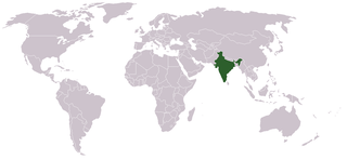
Location map for w:India.
User:dbenbenn modified Image:BlankMap-World.png.
அனுமதி
| |
This work has been released into the public domain by its author, Vardion, at the ஆங்கிலம் விக்கிப்பீடியா project. This applies worldwide. In case this is not legally possible: |
கோப்பின் வரலாறு
குறித்த நேரத்தில் இருந்த படிமத்தைப் பார்க்க அந்நேரத்தின் மீது சொடுக்கவும்.
| நாள்/நேரம் | நகம் அளவு சிறுபடம் | அளவுகள் | பயனர் | கருத்து | |
|---|---|---|---|---|---|
| தற்போதைய | 07:35, 11 செப்டெம்பர் 2021 | | 1,357 × 628 (21 KB) | Ytpks896 | Reverted to version as of 22:39, 12 February 2005 (UTC) |
| 13:37, 29 சூலை 2021 |  | 1,427 × 628 (103 KB) | Ytpks896 | Reverted to version as of 03:16, 1 May 2008 (UTC) | |
| 00:33, 15 பெப்பிரவரி 2010 |  | 1,357 × 628 (24 KB) | King Zebu | Reverted to version as of 09:17, 3 June 2005 Please discuss before making such edits in future. | |
| 03:16, 1 மே 2008 |  | 1,427 × 628 (103 KB) | KAVO | (Changed to colours more noticeable: *Light green - Claimed by India, not administered by India **(Aksai Chin, Azad Kashmir, Northern Areas, Shaksgam Valley) *Deep Green - Disputed with other nations, administered by India **(Arunachal Pradesh, Jammu and | |
| 09:17, 3 சூன் 2005 |  | 1,357 × 628 (24 KB) | Nichalp | NPOV map, please discuss any changes with me for NPOV status | |
| 22:39, 12 பெப்பிரவரி 2005 |  | 1,357 × 628 (21 KB) | Dbenbenn | higher resolution version, without black border | |
| 20:28, 5 திசம்பர் 2004 |  | 250 × 115 (18 KB) | EugeneZelenko | Location map for India.<br/>Originally created for English Wikipedia by Vardion.<br/>{{GFDL}} |
கோப்பு பயன்பாடு
பின்வரும் 2 பக்கங்கள் இணைப்பு இப் படிமத்துக்கு இணைக்கபட்டுள்ளது(ளன):
கோப்பின் முழுமையான பயன்பாடு
கீழ்கண்ட மற்ற விக்கிகள் இந்த கோப்பை பயன்படுத்துகின்றன:
- ar.wikinews.org-திட்டத்தில் இதன் பயன்பாடு
- ckb.wikipedia.org-திட்டத்தில் இதன் பயன்பாடு
- en.wikipedia.org-திட்டத்தில் இதன் பயன்பாடு
- en.wikinews.org-திட்டத்தில் இதன் பயன்பாடு
- en.wikivoyage.org-திட்டத்தில் இதன் பயன்பாடு
- en.wiktionary.org-திட்டத்தில் இதன் பயன்பாடு
- fr.wikinews.org-திட்டத்தில் இதன் பயன்பாடு
- fur.wikipedia.org-திட்டத்தில் இதன் பயன்பாடு
- he.wikivoyage.org-திட்டத்தில் இதன் பயன்பாடு
- hr.wikipedia.org-திட்டத்தில் இதன் பயன்பாடு
- hr.wikiquote.org-திட்டத்தில் இதன் பயன்பாடு
- incubator.wikimedia.org-திட்டத்தில் இதன் பயன்பாடு
- ko.wikipedia.org-திட்டத்தில் இதன் பயன்பாடு
- li.wikinews.org-திட்டத்தில் இதன் பயன்பாடு
- pam.wikipedia.org-திட்டத்தில் இதன் பயன்பாடு
- pl.wiktionary.org-திட்டத்தில் இதன் பயன்பாடு
- ps.wikivoyage.org-திட்டத்தில் இதன் பயன்பாடு
- pt.wikivoyage.org-திட்டத்தில் இதன் பயன்பாடு
- pt.wiktionary.org-திட்டத்தில் இதன் பயன்பாடு
- sr.wikibooks.org-திட்டத்தில் இதன் பயன்பாடு
- sv.wikinews.org-திட்டத்தில் இதன் பயன்பாடு
சிறப்பு பக்கம்-மொத்த பயன்பாடு - இதன் மூலம் இந்த கோப்பின் மொத்த பயன்பாட்டை அறிய முடியும்