படிமம்:LocationCzechRepublic.png
இதைவிட அளவில் பெரிய படிமம் இல்லை.
LocationCzechRepublic.png (250 × 115 படவணுக்கள், கோப்பின் அளவு: 6 KB, MIME வகை: image/png)
சுருக்கம்
Magyar: A Cseh Köztársaság elhelyezkedése
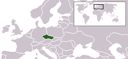
English: Location map for the Czech Republic. Originally created for English Wikipedia by Vardion.
அனுமதி
| |
This work has been released into the public domain by its author, Vardion, at the ஆங்கிலம் விக்கிப்பீடியா project. This applies worldwide. In case this is not legally possible: |
Template loop detected: Template:Autotranslate <includeonly></includeonly>
கோப்பின் வரலாறு
குறித்த நேரத்தில் இருந்த படிமத்தைப் பார்க்க அந்நேரத்தின் மீது சொடுக்கவும்.
| நாள்/நேரம் | நகம் அளவு சிறுபடம் | அளவுகள் | பயனர் | கருத்து | |
|---|---|---|---|---|---|
| தற்போதைய | 16:28, 6 சூன் 2006 | | 250 × 115 (6 KB) | Rain74 | Montenegro |
| 20:39, 5 திசம்பர் 2004 |  | 250 × 115 (7 KB) | EugeneZelenko | Location map for the Czech Republic.<br/>Originally created for English Wikipedia by Vardion.<br/>{{GFDL}} |
கோப்பு பயன்பாடு
பின்வரும் 4 பக்கங்கள் இணைப்பு இப் படிமத்துக்கு இணைக்கபட்டுள்ளது(ளன):
கோப்பின் முழுமையான பயன்பாடு
கீழ்கண்ட மற்ற விக்கிகள் இந்த கோப்பை பயன்படுத்துகின்றன:
- arc.wikipedia.org-திட்டத்தில் இதன் பயன்பாடு
- av.wikipedia.org-திட்டத்தில் இதன் பயன்பாடு
- awa.wikipedia.org-திட்டத்தில் இதன் பயன்பாடு
- bg.wikipedia.org-திட்டத்தில் இதன் பயன்பாடு
- bpy.wikipedia.org-திட்டத்தில் இதன் பயன்பாடு
- br.wikipedia.org-திட்டத்தில் இதன் பயன்பாடு
- bs.wikiquote.org-திட்டத்தில் இதன் பயன்பாடு
- csb.wikipedia.org-திட்டத்தில் இதன் பயன்பாடு
- de.wikipedia.org-திட்டத்தில் இதன் பயன்பாடு
- de.wikinews.org-திட்டத்தில் இதன் பயன்பாடு
- el.wiktionary.org-திட்டத்தில் இதன் பயன்பாடு
- en.wikipedia.org-திட்டத்தில் இதன் பயன்பாடு
- en.wikinews.org-திட்டத்தில் இதன் பயன்பாடு
- en.wikivoyage.org-திட்டத்தில் இதன் பயன்பாடு
- en.wiktionary.org-திட்டத்தில் இதன் பயன்பாடு
- fa.wikinews.org-திட்டத்தில் இதன் பயன்பாடு
- fiu-vro.wikipedia.org-திட்டத்தில் இதன் பயன்பாடு
- he.wikivoyage.org-திட்டத்தில் இதன் பயன்பாடு
- hi.wikipedia.org-திட்டத்தில் இதன் பயன்பாடு
- hr.wikipedia.org-திட்டத்தில் இதன் பயன்பாடு
- ia.wikipedia.org-திட்டத்தில் இதன் பயன்பாடு
- incubator.wikimedia.org-திட்டத்தில் இதன் பயன்பாடு
- it.wikinews.org-திட்டத்தில் இதன் பயன்பாடு
- ja.wiktionary.org-திட்டத்தில் இதன் பயன்பாடு
- jv.wikipedia.org-திட்டத்தில் இதன் பயன்பாடு
- kk.wikipedia.org-திட்டத்தில் இதன் பயன்பாடு
- ko.wikipedia.org-திட்டத்தில் இதன் பயன்பாடு
- ko.wiktionary.org-திட்டத்தில் இதன் பயன்பாடு
- ky.wikipedia.org-திட்டத்தில் இதன் பயன்பாடு
- la.wiktionary.org-திட்டத்தில் இதன் பயன்பாடு
- lij.wikipedia.org-திட்டத்தில் இதன் பயன்பாடு
- li.wikipedia.org-திட்டத்தில் இதன் பயன்பாடு
- lt.wiktionary.org-திட்டத்தில் இதன் பயன்பாடு
சிறப்பு பக்கம்-மொத்த பயன்பாடு - இதன் மூலம் இந்த கோப்பின் மொத்த பயன்பாட்டை அறிய முடியும்