படிமம்:Australia Locator Map.svg

Size of this PNG preview of this SVG file: 290 × 262 படப்புள்ளிகள். மற்ற பிரிதிறன்கள்: 266 × 240 படப்புள்ளிகள் | 531 × 480 படப்புள்ளிகள் | 850 × 768 படப்புள்ளிகள் | 1,133 × 1,024 படப்புள்ளிகள் | 2,267 × 2,048 படப்புள்ளிகள் .
மூலக்கோப்பு (SVG கோப்பு, பெயரளவில் 290 × 262 பிக்சல்கள், கோப்பு அளவு: 67 KB)
சுருக்கம்
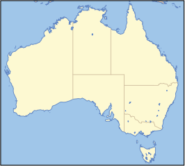
This map image was created by Wikipedia user Papayoung, based on the public-domain data available through the Map-It archive copy at the Wayback Machine interface.
Please note: This image is intended for use as a base map for a locator image; if you change or replace it in a way that moves its geographic features, images superimposed on it at specific locations will no longer be accurate. Please be careful. Thank you.
To use this image with a locator dot, see
locator map 250px wide
Use this code to make a locator map at 250px wide. See w:Image:Australia grid2.png for a reference map to use as a guide for the x and y values
{| align=right
|-
||
{{Superimpose| base = Australia_Locator_Blank.svg
  | base_width = 250px
  | base_caption = Australia
  | float = Locator_D. zoibird
  | float_width = 4
  | float_caption = Add caption here
  | x =
  | y =
}}
Add caption here
|}
அனுமதி
| இந்த கோப்பு Creative Commons Attribution-Share Alike 3.0 Unported உரிமத்தின் கீழ் உள்ளது. Subject to disclaimers. | ||
| ||
| This licensing tag was added to this file as part of the GFDL licensing update. |

|
GNU Free Documentation License விதிமுறைகளின் கீழ் இந்த ஆவணத்தை நகலெடுக்க, விநியோகிக்க மற்றும்/அல்லது மாற்றுவதற்கு அனுமதி வழங்கப்பட்டுள்ளது, Free Software Foundation;ஆல் வெளியிடப்பட்ட பதிப்பு 1.2 அல்லது அதற்குப் பிந்தைய பதிப்பு, மாற்றமில்லாத பிரிவுகள், முன் அட்டை உரைகள் மற்றும் பின் அட்டை உரைகள் இல்லாமல் வெளியிடப்பட்டது. GNU Free Documentation License என்ற தலைப்பில் உரிமத்தின் நகல் சேர்க்கப்பட்டுள்ளது. Subject to disclaimers. |
(Delete all revisions of this file) (cur) 06:09, 31 October 2005 . . Papayoung (Talk) . . 290x262 (68813 bytes) (This map image was created by Wikipedia user Papayoung, based on the public-domain data available through the Map-It interface (http://stellwagen.er.usgs.gov/mapit/ archive copy at the Wayback Machine).)
derivative works
Derivative works of this file:
கோப்பின் வரலாறு
குறித்த நேரத்தில் இருந்த படிமத்தைப் பார்க்க அந்நேரத்தின் மீது சொடுக்கவும்.
| நாள்/நேரம் | நகம் அளவு சிறுபடம் | அளவுகள் | பயனர் | கருத்து | |
|---|---|---|---|---|---|
| தற்போதைய | 21:42, 19 திசம்பர் 2005 | | 290 × 262 (67 KB) | Boticario | == Summary == This map image was created by Wikipedia user Papayoung, based on the public-domain data available through the [http://stellwagen.er.usgs.gov/mapit/ Map-It] interface. <div style="border: 1px solid #F66; padding: 1em |
கோப்பு பயன்பாடு
இப் படிமத்துக்கு இணைக்கப்பட்டுள்ள பக்கங்கள் எதுவும் இல்லை.
கோப்பின் முழுமையான பயன்பாடு
கீழ்கண்ட மற்ற விக்கிகள் இந்த கோப்பை பயன்படுத்துகின்றன:
- ar.wikipedia.org-திட்டத்தில் இதன் பயன்பாடு
- en.wikipedia.org-திட்டத்தில் இதன் பயன்பாடு
- es.wikipedia.org-திட்டத்தில் இதன் பயன்பாடு
- Parque nacional Boorabbin
- Parque nacional Cabo Árido
- Parque nacional Monte Remarkable
- Parque nacional Río Murray
- Parque nacional Lago Gairdner
- Parque nacional Lago Torrens
- Parque nacional Charles Darwin
- Parque nacional Churchill
- Parque nacional Elsey
- Parque nacional Djukbinj
- Parque nacional Garganta Finke
- Parque nacional Montañas Dulcie
- Parque nacional Undara Volcánico
- Parque nacional Michaelmas y Cayos Upolu
- Parque nacional Meseta Hann
- Parque nacional Shannon
- Parque nacional Bosque Tuart
- Parque nacional Montañas Yarra
- Parque nacional Alexander Morrison
- Parque nacional MacDonnell Oeste
- Parque nacional Nitmiluk
- Parque nacional Garig Gunak Barlu
- Parque nacional Ku-ring-gai Chase
- Parque nacional Kalbarri
- Parque nacional Río Onkaparinga
- Parque nacional Montes Vulkathunha-Gammon
- Parque nacional Montes Flinders
- Parque nacional Montes Gawler
- Parque nacional Errinundra
- Parque nacional Gran Otway
- Parque nacional Badgingarra
- fr.wikipedia.org-திட்டத்தில் இதன் பயன்பாடு
- ja.wikipedia.org-திட்டத்தில் இதன் பயன்பாடு
- ka.wikipedia.org-திட்டத்தில் இதன் பயன்பாடு
- ml.wikipedia.org-திட்டத்தில் இதன் பயன்பாடு
- ms.wikipedia.org-திட்டத்தில் இதன் பயன்பாடு
- pt.wikipedia.org-திட்டத்தில் இதன் பயன்பாடு
- simple.wikipedia.org-திட்டத்தில் இதன் பயன்பாடு
சிறப்பு பக்கம்-மொத்த பயன்பாடு - இதன் மூலம் இந்த கோப்பின் மொத்த பயன்பாட்டை அறிய முடியும்